April 05, 2017
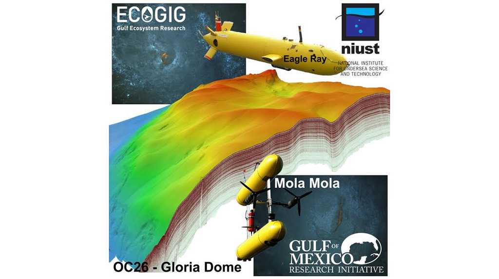
Mississippi scientists surveyed natural seeps near the Macondo blowout using a high-resolution autonomous underwater vehicle (AUV) to inform biogeochemical studies about the post-Deepwater Horizon water column and seafloor. The researchers observed that the most distinctive physical features of the seepage systems were elongated depressions, pockmarks, and mud volcanoes/mounds. Visual imagery showed seep clusters on the periphery of salt domes and the presence of benthic communities and gas hydrate outcrops. These observations enhance current knowledge about seafloor morphology and how it relates to natural gas seepage processes. The scientists published their findings in Deep Sea Research Part II: Topical Studies in Oceanography: Morpho-acoustic characterization of natural seepage features near the Macondo Wellhead (ECOGIG site OC26, Gulf of Mexico).
Tectonically-active salt bodies such as the Gulf of Mexico produce networks of faults and fractures that can act as natural pathways for hydrocarbon seepage. Researchers identified precise locations for naturally occurring hydrocarbon seeps and used acoustic and optical sensors to collect seafloor morphology, seafloor sediment reflectivity, and water column data as well as photographs and subsurface seismic images.
Mud volcanoes/mounds and pockmarks were prevalent in the northeast region of the study site, while elongated depressions characterized the southwest region. Subsurface images revealed trapped gas and chimney structures – which often represent direct pathways for hydrocarbons to enter the water column – beneath all three features, suggesting that the structures resulted from or were associated with seep processes.
Depressions and pockmarks were associated with areas that contained a high percentage of gassy soft sediments. The shape and structure of mud volcanos and mounds offered details about the activity, pressure, and viscosity involved in their creation.
Study co-author and ECOGIG PI Arne R. Diercks commented that collecting data using AUVs was challenging. “Work with AUVs is limited by the data resolution needed, the size and depth of our target area, and the amount of energy we can take [to the seafloor] to run the instruments,” he explained. “My team managed to hit the target area on our first try. Getting a fully functional high-tech computer to the seafloor and autonomously navigate a preprogrammed path in complete darkness without a GPS and successfully collect data takes a great effort and a good team.”
Data are publicly available through the Gulf of Mexico Research Initiative Information & Data Cooperative (GRIIDC) at R1.x132.137:0012.
The study’s authors are A. Conti, M. D’Emidio, L. Macelloni, C. Lutken, V. Asper, M. Woolsey, R. Jarnagin, A. Diercks, and R.C. Highsmith.
************
This article was written by Maggie Dannreuther and originally appeared here.
This research was made possible in part by a grant from the Gulf of Mexico Research Initiative (GoMRI) to the Ecosystem Impacts of Oil and Gas Inputs to the Gulf-2 (ECOGIG-2) consortium. Other funding sources included the Marie Curie Fellowship co-funded by the European Union under FP7-People — co-funding of Regional, National and International Programmes, GA n. 600407 and RITMARE Flagship Project.
The Gulf of Mexico Research Initiative (GoMRI) is a 10-year independent research program established to study the effect, and the potential associated impact, of hydrocarbon releases on the environment and public health, as well as to develop improved spill mitigation, oil detection, characterization and remediation technologies. An independent and academic 20-member Research Board makes the funding and research direction decisions to ensure the intellectual quality, effectiveness and academic independence of the GoMRI research. All research data, findings and publications will be made publicly available. The program was established through a $500 million financial commitment from BP. For more information, visit http://gulfresearchinitiative.org/.


 back to top