January 24, 2020
Scientists employed autonomous underwater vehicle-borne seismo-acoustics and photography to provide insights into the origins, dynamics, and evolution of an active hydrocarbon seep in the Green Canyon Lease Block 600. The study area’s present-day seabed conditions exhibit a complex system of faults, pockmarks, mounds, gullies, irregular bathymetry, and a vigorous hydrocarbon flux. The most prominent features of the site are several mounds that actively vent hydrocarbons. Mounds are aligned along a ridge structure that has authigenic carbonate hardgrounds (where coral and other marine life colonize), gas hydrates, and chemosynthetic communities. Detailed bathymetry of the mounds’ surface highlights the presence of numerous pockmarks, cones, and micro-mounds of variable sizes and shapes. These observations improve our current knowledge about seafloor morphology and its relationship to seepage processes; new findings also serve as a comparison for ecosystem response to large deep-ocean oil and gas intrusions, such as the Deepwater Horizon incident.
The researchers published their results in Marine Geophysical Research: High-resolution seismo-acoustic characterization of Green Canyon.
The continental slope of the Gulf of Mexico has one of the most complex seafloor morphologies among the world’s oceans, with a rough bathymetry that reflects a complex underlying geologic framework. More than 20,000 natural hydrocarbon seeps populate its seafloor (MacDonald et al. 2015 and Garcia-Pineda et al. 2016).Increased oil and gas extraction activities in the Gulf have contributed to episodic anthropogenic discharges, such as occurred during the Deepwater Horizon incident.
GC600 is located on the Gulf of Mexico’s lower continental slope in approximately 1250 m depth, 200 km from the Louisiana coast and 260 km from the Deepwater Horizon rig. GC600 is a dynamic site that actively vents oil and gas in amounts that satellite imagery can detect as slicks on the sea surface. The presence of hydrocarbon molecules at the water–sediment interface supports diverse microbial communities, including methane oxidizers and sulfate reducers and complex chemosymbiont communities. The metabolic byproducts of these microbial processes facilitate production of authigenic carbonates, the solid substrates on which macrofaunal organisms colonize.
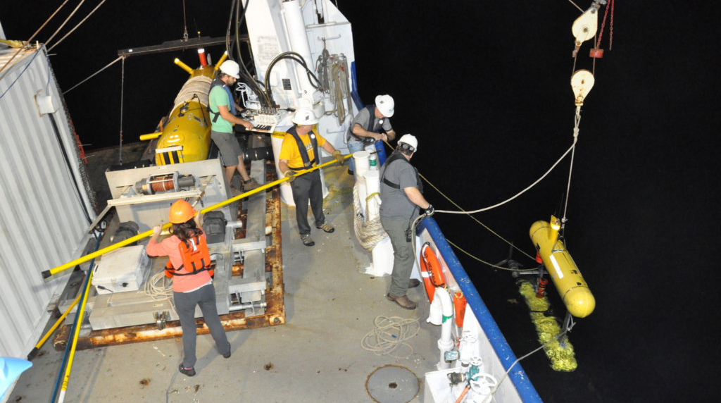
The active venting of oil and gas produces changes to the seafloor morphology over time through formation of new pockmarks and changes to existing pockmarks. This study’s team sought to improve our knowledge about the present-day conditions of the area by employing a multibeam echosounder, chirp sub-bottom profiler, and digital still camera. They maximized imaging resolution by collecting data with two autonomous underwater vehicles, the Eagle Ray (which captured the complex structure of the mounds) and the Mola Mola (which revealed details about sediment types and habitat on these mounds). The team located the bubble plumes hydroacoustically using a hull-mounted multibeam during a 2012 RV Falkor research expedition to link active emission points with the site’s morphology and underlying geology.
“This paper offers a possible explanation of how the observed seafloor morphology in the study area formed,” explained study author Arne Diercks. “A successive evolution of a natural gas chimney into a pockmark and finally into a mound is discussed as being primarily depending on the architecture and maturity of the plumbing system.”
Diercks interprets the features at and below the seafloor as the result of salt-tectonic processes that allow interconnection between the seafloor and the subsurface via a complex network of major and minor faults. “The faults deform the seabed, uplifting some areas and lowering others, and provide pathways for the natural migration of hydrocarbons (oil and gas) from their deep reservoirs to the seabed. From here these hydrocarbons can migrate into the water column and potentially reach the sea surface, producing one of the many naturally occurring oil slicks visible in satellite imagery in the Gulf of Mexico.”
Data for this study are publicly available through the Gulf of Mexico Research Initiative Information & Data Cooperative (GRIIDC) at DOI 10.7266/N72V2D45.
The study authors are Arne‑R. Diercks, Leonardo Macelloni, Marco D’Emidio, Samantha Lucker, Allison Woolsey, and Maxwell U. Woolsey.
Read about related ECOGIG research:
-
Study Characterizes Oil and Gas Bubbles Released from Natural Hydrocarbon Seeps
-
Seafloor Rescue – Universities Collaborate for Amazing Recovery of Downed AUV
-
Shipboard blogs during the 2012 R/V Falkor expedition: Percolating Seeps, Diving on the Megaplume, and Detecting Oil from the Sky and Sea
************
This article was written by Nilde Maggie Dannreuther and originally appeared online here. Contact maggied@ngi.msstate.edu with questions or comments.
This research was made possible in part by grants from the Gulf of Mexico Research Initiative (GoMRI) to the Ecosystem Impacts of Oil and Gas Inputs to the Gulf-2 (ECOGIG-2) and to the University of Southern Mississippi for the project Resuspension, Redistribution and Deposition of Deep Water Horizon (DwH) Recalcitrant Hydrocarbons to offshore Depocenters. Other support included a NOAA Award NA07AR4300464 to the National Institute for Undersea Science and Technology.
The Gulf of Mexico Research Initiative (GoMRI) is a 10-year independent research program established to study the effect, and the potential associated impact, of hydrocarbon releases on the environment and public health, as well as to develop improved spill mitigation, oil detection, characterization and remediation technologies. An independent and academic 20-member Research Board makes the funding and research direction decisions to ensure the intellectual quality, effectiveness and academic independence of the GoMRI research. All research data, findings and publications will be made publicly available. The program was established through a $500 million financial commitment from BP. For more information, visit http://gulfresearchinitiative.org/.
© Copyright 2010-2020 Gulf of Mexico Research Initiative (GoMRI) – All Rights Reserved. Redistribution is encouraged with acknowledgement to the Gulf of Mexico Research Initiative (GoMRI). Please credit images and/or videos as done in each article. Questions? Contact web-content editor Nilde “Maggie” Dannreuther, Northern Gulf Institute, Mississippi State University (maggied@ngi.msstate.edu).


 back to top