ECOGIG scientists rely on a variety of tools to collect observations such as water temperatures and salinities, chemicals seeping from the bottom of the Gulf of Mexico (such as methane and hydrocarbons), the shape of the seafloor, and the speed of currents. Using specialized systems and sensors to record and monitor water column conditions and to collect samples for analyses gives ECOGIG enhanced understanding of the Gulf of Mexico's ecosystems.
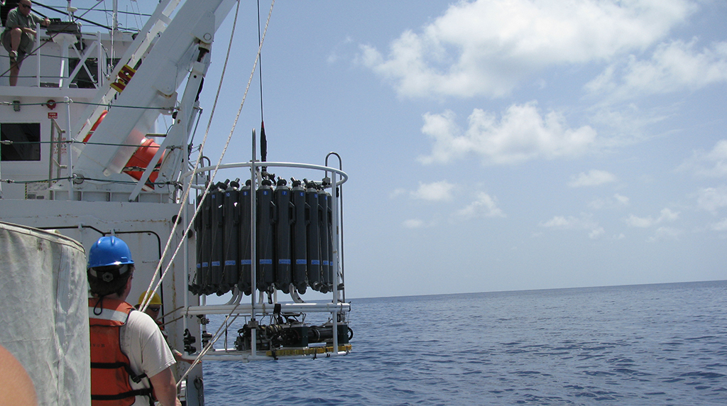
CTD Rosette
The CTD (conductivity, temperature, depth) rosette contains an instrument with sensors that measure temperature, salinity, depth, chlorophyll (an indicator of phytoplankton biomass), colored dissolved organic matter (“CDOM,” which includes oil), and transmissometer (which essentially detects particles in the water). The rosette also contains special bottles for collecting water at a specific depth. Researchers trigger the bottles at depths where they see interesting signals in the data, and they use the water for measuring methane gas concentration and oxygen consumption rates on board the ship.
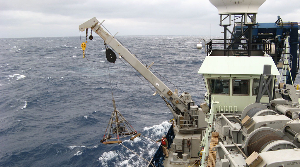
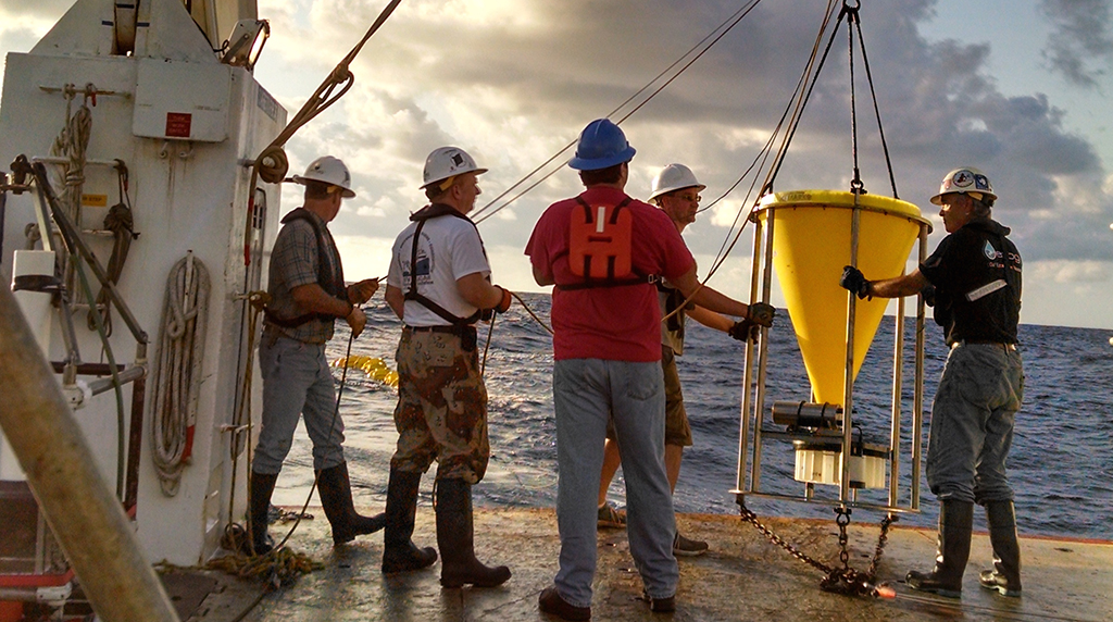
Multiple corer
A multiple corer (aka MUC or multicorer) collects samples of sediment (in the form of cores) from the seafloor at great depths, penetrating the sediment-water interface for collection. It can take up to 8 samples at one time.
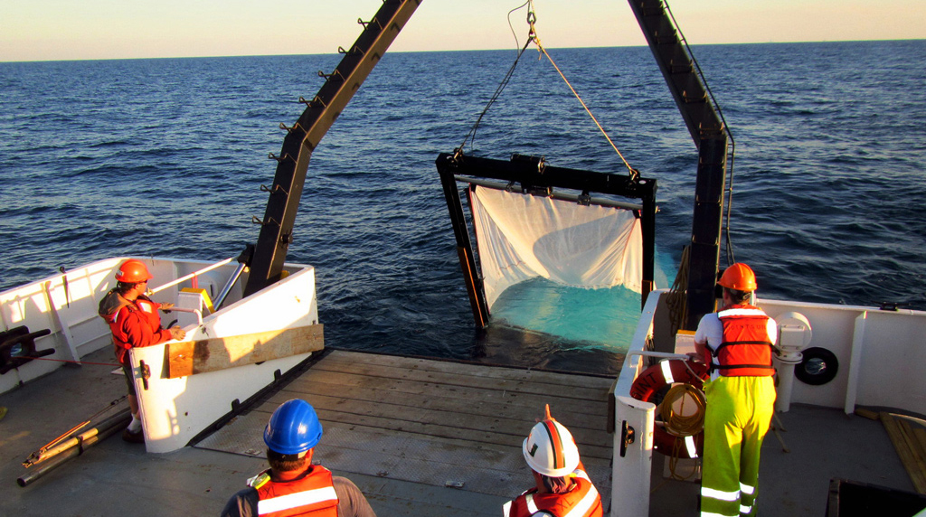
Plankton nets
A plankton net is a very fine mesh (30-200 microns) that is towed near the surface to collect organisms. There are several kinds of plankton nets- one that is most commonly used by ECOGIG is the MOCNESS (Multiple Opening and Closing Net and Environmental Sampling System) which is used to collect zooplankton from different depths in the water column. The system of multiple nets (6 - 20) is towed slowly (2-3 knots) behind a research vessel; each net can be opened and closed independently, a decision reached by studying real time data about water conditions—conductivity (salinity), temperature, depth, as well as chlorophyll, oxygen, and light levels—that is relayed by sensors mounted on the instrument frame. The nets are tapered and up to 18 meters (60 feet) long and are made of mesh with holes sized to catch various kinds of plankton. Using MOCNESS, scientists can determine zooplankton distributions in specific areas of the ocean.The system provides control over where and when samples are taken and, with the multiple nets, eliminates the need for repeat passes over an area, thus saving ship time and reducing the risk of changing the water characteristics between samplings.
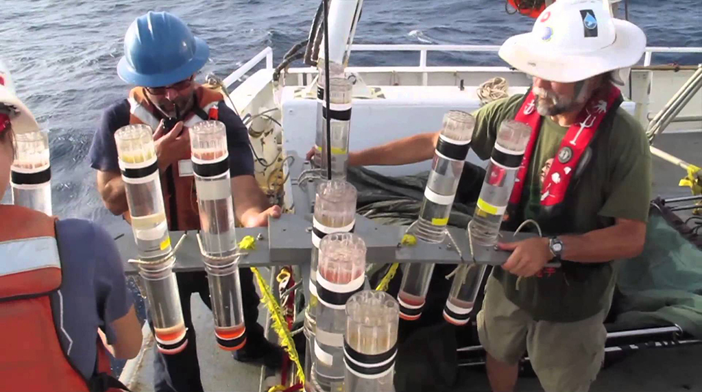
Sediment traps
Also known as particle interceptor traps, sediment traps vary. Some float (drift) on the surface of the ocean, and some are moored to the ocean bottom. Floating sediment traps use buoys that stay at the ocean surface while the sediment-collecting tubes are lowered to desired depths for collection of matter dropping through the water column from above. A floating sediment trap measures the quantity of sinking particulate organic and inorganic materials (animal waste, inorganic particles, etc.) that are the product of biological and ecological processes in the upper, sunlit water column. Moored sediment traps remain in place on the ocean bottom for one year and collect one integrated sample each month. The carbon, nitrogen, phosphorus, and silica cycles—to name a few—are affected by sinking particulate matter. Sediment traps help scientists understand changes to those cycles when there is a disturbance to the system, like an oil spill, by providing data that shows the fate of oil (for instance) on the sea surface and in the water column. Carbon, nitrogen, phosphorus, and silica are some of the essential nutrient elements that are required by all living organisms no matter their position in the food web. Understanding what changes the abundance of these elements, like increased particulate matter flux due to a disturbance, can help us understand how disturbances like oil spills alter materials flow in the oceanic system.
Spectroradiometer
Scientists measure the color of the water using an Analytical Spectral Devices (ASD) spectroradiometer. They point the instrument at the water to measure the color of the water, and point it at the sky to get the color of the sky and then subtract this from the color of the water to get rid of the reflection at the surface. The resultant spectrum is then assumed to come from the water column and can be used to calculate the contents of the water column such as how much phytoplankton and dissolved organic matter there is. It also allows them to measure the spectrum of floating oil slicks.
Video time lapse camera system
The Video Time Lapse Camera (VTLC) is placed on the seafloor near a hydrocarbon seep. It records 15 seconds of video every 5 minutes. Streams of bubbles are recorded along with a continuous 10 second recording of water temperature and pressure. This technology was developed and is used frequently by Dr. Ian MacDonald (ECOGIG).
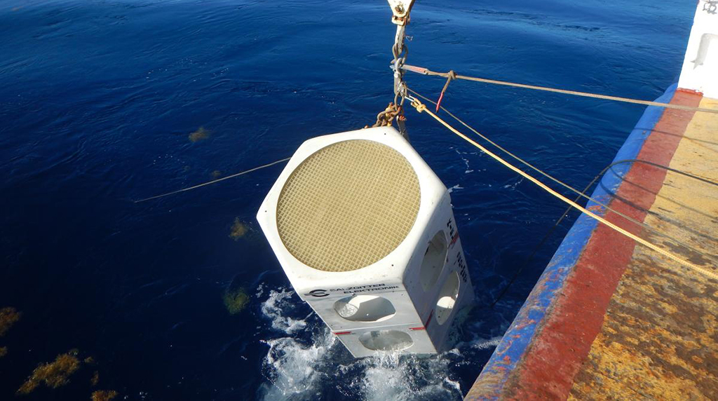
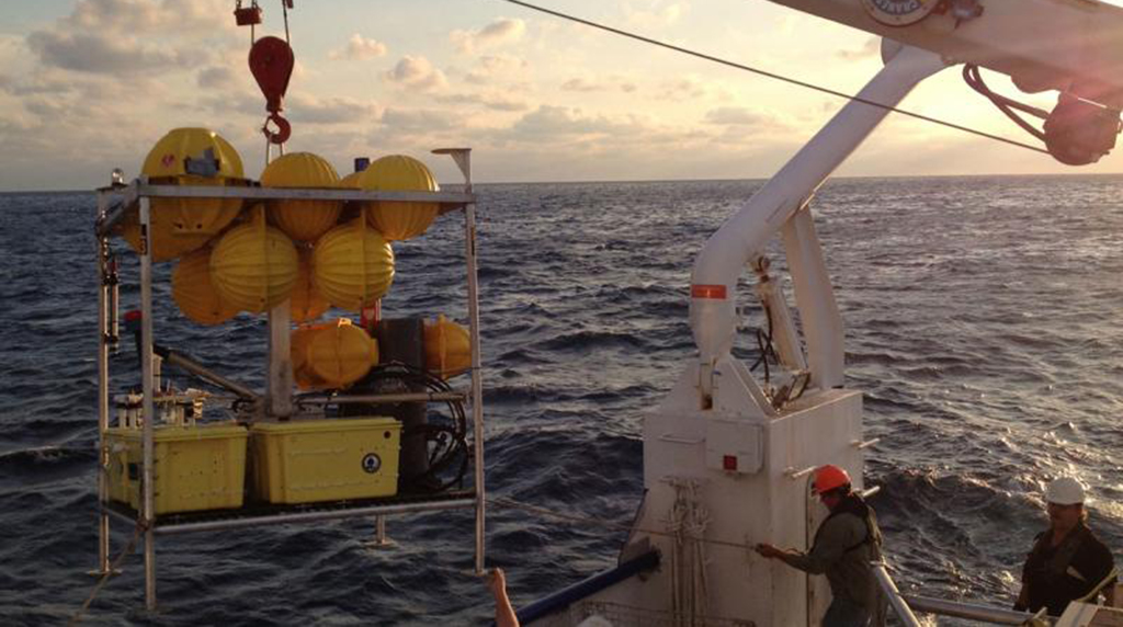
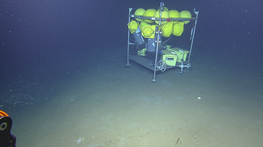
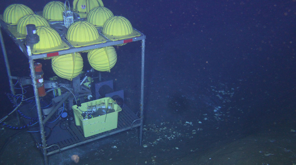
Lander (MILET)
A Modular Instrument Lander and Equipment Toolsled (MILET) is a platform that carries several instruments, such as cameras, CTD, chirp subbottom profiler, etc. It has a fiber optic winch and cable system for real-time imaging and instrument read-out. Some sensors that ECOGIG frequently attaches to MILET include the following:
Acoustic Doppler Current Profiler (ADCP)
High frequency pulses from the instrument bounce off moving particles in the water and return at either higher or lower frequencies, depending upon whether they are moving away (lower) or towards (higher) the ADCP. The frequency shift is proportional to the current, or speed of the water. The instrument has four acoustic transducers emitting pulses in four different directions; calculations then determine current direction. Knowing the current speed and direction helps scientists determine the transport of nutrients, organisms, and other matter throughout the ocean.
Chimney Sampler Array (CSA)
The CSA systems utilize unique, advanced underwater sensors for measuring current velocity and direction, dissolved oxygen and methane, plus temperature, salinity, turbidity and pressure (depth). The time-series data obtained in these measurements can provide critical information including variability in hydrocarbon concentrations derived from plumes emanating from either natural seeps or accidental release sites, dissolved oxygen drawdown associated with microbial degradation processes or changes in water mass mixing and the effects of tidally driven pressure changes at the seafloor. Current direction and velocity data can be used to determine upstream sources of hydrocarbons or other causes of change such as physical mixing. The CSA was designed by Dr. Chris Martens (ECOGIG).
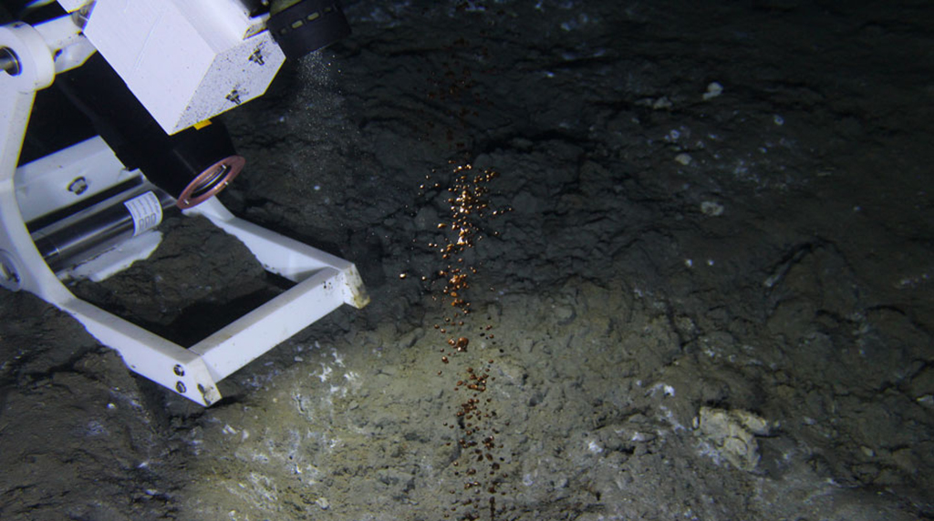
Microbial Methane Observatory for Seafloor Analysis (MIMOSA)
The MIMOSA uses low-cost technology to continuously collect, in parallel, fluid samples from sediment and water to document changes in methane and hydrocarbon concentration, in dissolved metals and other ions, and in microbial community composition.The system also allows the scientists to continuously inject various enrichment substrates — such as oil, dispersant, and labeled food — into the environment on a small scale, to see how microbes respond. This type of system provides a unique means to determine the manner in which microbes respond to oil and gas inputs in deep-water sediment environments.